题目内容
If you are a visitor,you may look for the post office in a foreign country.Can you imagine (想像)how those people will tell you the way?
In the countryside of American Middle West,people will tell you,‘Go north three miles.Turn east,and then go another two miles.’
While in Los Angeles,California,the American people have no idea of the distance on the map.‘How far is the post office?’ you ask.‘oh,’ they answer,‘it is about ten minutes by taxi from here.’But in fact,they don't know how far it is.
In Greece(希腊),a Greek will often say,‘Follow me.’Then he'll go with you through the streets of the city to the post office.
In many places, people usually say ‘Sorry,I don't know’ when they can't tell you the way.However,in Mexico(墨西哥),the people think ‘I don't know’ is not polite(有礼貌的).They usually give an answer, often a wrong one.
So you must be careful of their habits (习惯) when you are asking the way in a foreign country.
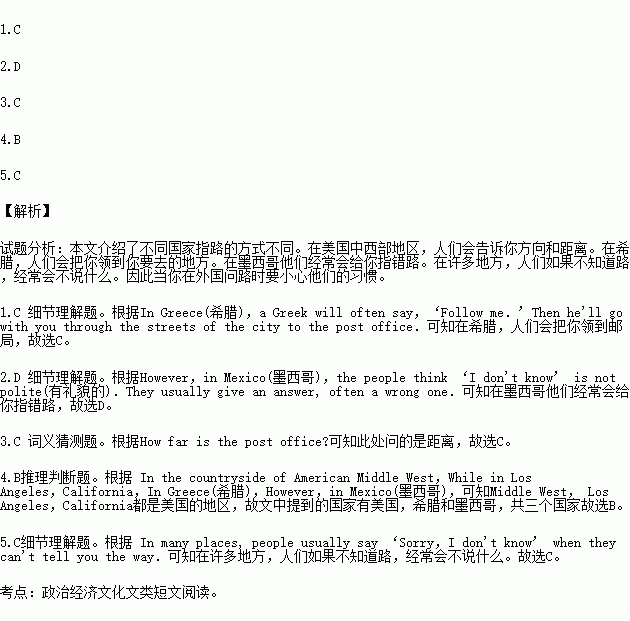
1. In ,the people don't tell you the direction but lead(引导) you to the post office.
A. Japan B. America C. Greece D. Mexico
2.You will often lose your way in because the people can't
give you the right direction.
A. Japan B. America C. Greece D. Mexico
3.The underlined word ‘distance’ means‘ ’ in Chinese.
A. 方向 B. 地方 C. 距离 D. 终点
4. countries are mentioned(提到) in the passage?
A. Two B. Three C. Four D. Five
5.What do people usually do if they don't know the way?
A. They lead you to the place.
B. They give you a wrong answer.
C. They say nothing.
D. They say ‘Sorry,I don't know.

 轻松夺冠全能掌控卷系列答案
书面表达(5分)
假设你叫陈军,昨天收到了笔友David的e-mail,得知他要到无锡来旅游。他想先了解无锡的情况。请你用英文给他回复一封e-mail,介绍无锡的吃、游、购等情况。
要点提示:
“吃”在无锡 | 无锡有大量的餐馆,你可以品尝许多本地美食。 |
“游”在无锡 | 无锡有许多著名的景点,比如蠡湖(Li Lake)。 |
“购”在无锡 | 无锡有很多大商场,可以为你的家人买礼物。 |
总结 | …… |
注意:1. 邮件须包括所给内容要点,要求语句通顺,意思连贯,书写规范;
2. 省略部分须用1-2句话作适当发挥;
3. 词数60字左右。邮件的开头和结尾已给出,不计入总词数。
Dear David,
I’m glad to hear that you’ll come to Wuxi. _______________________________________________________________
_________________________________________________________________
________________________________________________________________
Hope to see you soon in Wuxi.
Yours
Chen Jun